 |
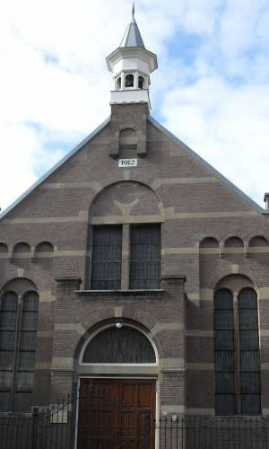
Beverwijk
Wijkermeerpolder
The relatively new Wijkermeerpolder (the first preparations were made in 1856 and the land was ready for use in 1877) is 700 hectares. It extends from Beverwijk to Assendelft, from the North Sea Canal to the village of Nauerna.
Most of the Wijkermeerpolder is part of the municipality of Zaanstad. If you are curious to know how far the waves of the IJ (the former Zuiderzee) and the Wijkermeer lake came, all you need to do is drive along the winding dykes Noorder IJdijk and Zeedijk. This gives you a good idea of the rugged edge of the old Wijkermeer shoreline. The Wijkermeer lake gradually silted up in the 17th and 18th century. Only if there was a really bad storm did the water come right up to the top of the Breestraat. The last time that the people who lived at the De Meer harbour or in the Breestraat had to rush up to their attics to escape the rising water was in 1865. In previous years this had happened every winter.
From the 17th century Beverwijk did all it could to keep the waterway into the harbour open. After all, there was no faster or cheaper way of transporting vegetables, fish, cloth, oil and other products than over the Wijkermeer lake.
It turned out to be an impossible task. They could not stop the silting and that made life hard for the Beverwijk tradesmen. A new waterway to Amsterdam (the North Sea Canal) was not built for another 100 years. The lake was finally impoldered in 1873, at the same time as work started on the North Sea Canal. The canal was completed in 1876 and the regional economy began to flourish once more. The polder provided 700 hectares of fertile land. Up until now most of the Wijkermeer polder has been used for livestock and arable farming. Potatoes, beets and cereals are the crops produced. But as employment, the need for homes and recreation demand more space, it looks like agriculture is beginning to take second place.
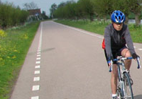
If you like cycling, then you will love the Wijkermeerpolderroute. Along the old seadyke to the village of Assendelft and then back along the Communicatieweg or alongside the Northseacanal. On the way you will see many interesting parts of our military history: the remains of the old firing line 'the Amsterdam Defence Line'. This 135 km circular line of defence around the capital consists of 42 forts, batteries, rampart lines and powder magazines. When it had been completed (1920), the introduction of fighter planes instantly made the firing line obsolete. In 1988 the province of Noord-Holland gave the Amsterdam Defence Line national heritage status. In 1995 it was even included in the UNESCO World Heritage List. The Defence Line section in the Wijkermeerpolder includes four forts and a part of the fortified dyke from Beverwijk to the village of Krommenie. The forts are Sint Aagtendijk, Veldhuis, de Eersteling and Zuidwijkermeer.
On summer Sundays, the Veldhuis fort is open to the public. The Aircraft Recovery Group Trust has setup a permanent exhibition in the former powder magazines and soldiers' quarters. The Stichting Noordhollands Landschap (provincial landscape trust) looks after the Veldhuisfort and the fortified dyke from the town of Heemskerk to Krommenie. The dyke now attracts as many visitors as the forts. This is as much to do with the grebes and tufted ducks swimming around in the moats as the wild flowers growing there.
|
|
|
|
|
|